
The Centennial Gallery
Follow visitburnslake on Facebook and Instagram
100 years of being awesome!
Insert the loudest horn ever – Have you heard? Burns Lake is a centenarian!! (that means 100 years of being awesome)
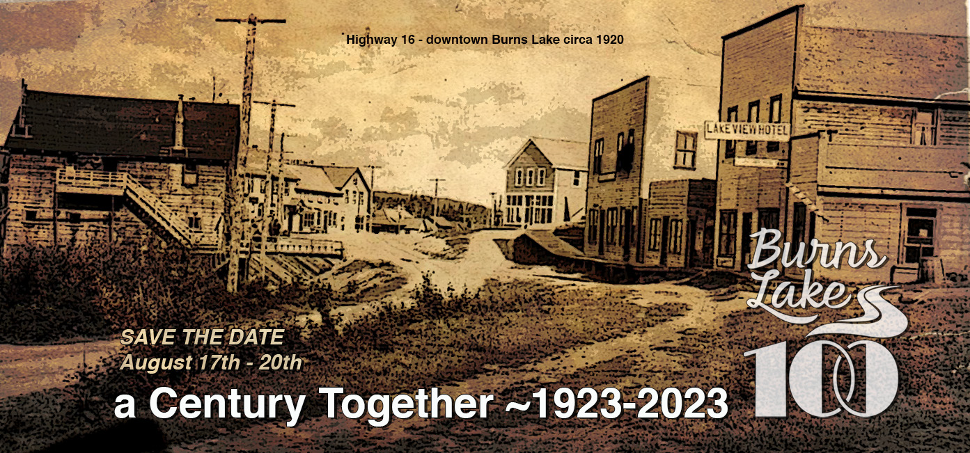
Burns Lake has only been an incorporated municipality for a century, but the community itself is much older.
Oral history and archaeological evidence suggest that Indigenous people have lived along the shores of Tselh K’iz Bin (the Witsuwit’en name for the body of water we now call Burns Lake) for hundreds if not thousands of years. There was a thriving indigenous community here when American travel writer Hamlin Garland passed through in 1898, and at least three Witsuwit’en families were in residence when Trygarn Pelham Lyster “Barney” Mulvany camped nearby in 1906.
The area’s wealth of natural resources attracted the attention of colonial interests in the nineteenth century. Although representatives of the Northwest Company (and, later, the Hudson’s Bay Co.) traded with the region’s Indigenous people in the early 1800s, it wasn’t until surveyors for the Collins Overland Telegraph passed through this area in 1865-66 that Euro-Canadians got their first good look at what is today Burns Lake. The Collins Overland Telegraph— and, thirty-three years later, the Yukon Telegraph—constructed a maintenance cabin on what is now Richmond Loop. The unknown telegraph operator who manned the station was likely Burns Lake’s first permanent Euro-Canadian resident.
A few hardy settlers, like George “The Boer” Wallace, Dick Carroll, and the Gerows (Don and Robert), followed, but it wasn’t until the completion of the Grand Trunk Pacific Railway in 1914 that a community of any size existed here. That’s when a redheaded adventurer named Trygarn Pelham Lyster “Barney” Mulvany won the contents of an entire railway construction camp in a poker game and decided the place he camped in 1906 would be a good town site. Mulvany pitched two tents a couple hundred yards from the shore of Burns Lake. We could go on and on, to find out more about the rich history of the Lakes District stop in at the Lakes District Museum, conveniently located next to the Visitor Information Centre.
What makes Burns Lake unique?
What is distinctive to Burns Lake? What is one thing that when you describe Burns Lake people go ahhhh yep that sounds about right!!
- One & only traffic light
- All four seasons in an hour, especially on May-long weekend
- Coming “home” you MUST hit China Moon for a #5 and the Bakery for a sausage roll!
- Everyone seems to know someone who is related to someone in Burns Lake
- We should also mention our great sarcasm
- Young born and raised Burns Lakers can’t wait to leave the nest, but there’s just something comforting about Burns Lake that always draws you home!
Lots has changed since the infamous red-headed Mr. Mulvaney won a tent town in a game of poker.
Burns Lake has survived countless fires, the Great Depression, and a couple of minor recessions since 1923. Today the village Mulvany fondly referred to as “this old tent town of mine” is a thriving, modern community with a bright future. And while much has changed here in a hundred years, the community spirit that played such a key role in building this town remains intact. The one constant thing that has remained tried and true is Burns Lake’s crooked little street!
Carve your path... in every direction
From the Burns Lake Visitor Centre follow Highway 16 east to find Imerson’s Beach, Homeside Antiques, Coop Lake, and lastly Richmond Lake.
On your way south on highway 35 you’ll find Talon Point, the John Shelford Opal Bed Trail via eagle creek rd., the bear dens trail, Omineca Ski club, Burns Lake South/Ridler Trail, Guyishton Lake and rec site, and Agate Point via Tchesinkut Rd. E finally reaching the Ferry Landing (to the Southside) and boat launch. Continue past the ferry landing for a scenic drive with views of Francois lake to McLure Pit rec site, Colleymount rec site, Noralee store and resort, Nadina mountain and resort, Tahtsa Reach, Owen Lake, and the Morice river eventually taking you through to Houston.
Head west to find the Walk a dab trail (Rose Lake), Maxan Lake (Broman Lake and Forestdale area), and Day Lake. Almost 50 km from Burns Lake you’ll hit the small community of Topley where you can enjoy the Sunset Lake rec site. If you want to keep exploring turn right on highway 118 to Granisle; a small lakeside mining community with fisheries, a marina, and the hub to Babine Lake.
There are a few ways to head north. Driving from the Visitor centre up 5th ave. to access the Kager Lake and the Boer Mountain Trail systems or hiking/biking from the Visitor Centre up the EVENESHEN NATURE TRAIL connecting to the Rod Reid trail linking to the newly developed Magee trail ending at the Boer Mountain bike Park. Returning to highway 16, turn right on to Babine Lake rd for a picturesque drive to Division Lake, Pinkut Lake rec site, Taltapin Lake rec site, Pinkut fisheries, Augier Lake, Pendleton Bay Marine Park (on Babine Lake), and the Babine Lake resort
Carve your path... to the Southside
Traveling a short 23 km south of Burns Lake on Highway 35 takes you to the grandeur of Francois Lake. Here waits the Francois Forester to transport you effortlessly across the lake to an area that is steeped in First Nations and settler history – the Southside. The Southside is the traditional territory of the people of the Cheslatta Carrier Nation, Skin Tyee and Nee Tahi Buhn.
Arriving at Southbank, visitors have the opportunity to head East to the areas of Uncha, Binta and Knapp Lakes – lakes well-known for their fabulous fishing. Heading south from Southbank will take you through the historic communities of Danskin and Grassy Plains. Keep heading south on Keefe’s Landing Road and you’ll get to the junction for Takysie Lake and Ootsa Lake. Travelling straight onto Eakin Settlement Road will bring you to Takysie Lake. Food and fuel services (including diesel) are available. The road now turns to well-maintained gravel. Time to slow down and keep an eye out for the abundant wildlife. The next junction is the scenic Cheslatta Road which takes you past the Upper Cheslatta Falls, to Cheslatta Lake and the trailhead of the historic Cheslatta Trail. Back to the Eakin Settlement Road and another 15 minutes of driving and you will find yourself at the Nechako Reservoir or as the locals call it, Ootsa Lake. Ootsa Lake was flooded in 1952 as part of the Kemano I project that established reliable, clean, renewable power to be transmitted to the Rio Tinto aluminium smelter in Kitimat. Take time to enjoy the free campground and picnic area adjacent to the turbulent waters of the Spillway. Another junction, another choice! Travelling east over the spillway leads to the historic settlement of Marilla and the roaring waters of the Lower Cheslatta Falls. Travel west along the Ootsa Lake Road with sweeping views of Tweedsmuir Provincial Park until, you guessed it – another junction. Head back to the Southbank ferry terminal by getting back on Keefe’s Landing Road or continue along Ootsa Lake Road (back to pavement) to the settlements of Streatham and Wistaria – so many beautiful sights along the way!

